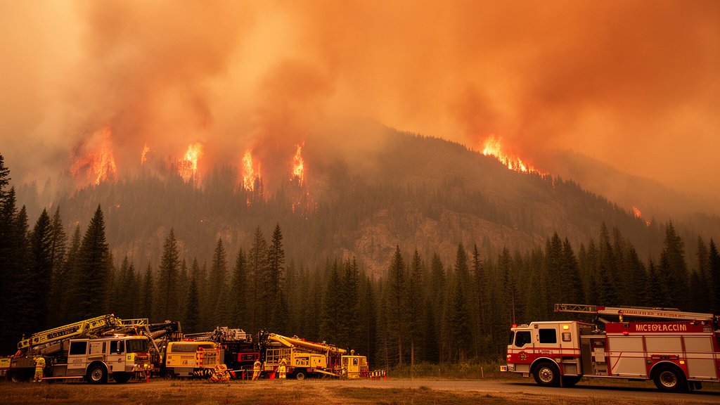
The Pacific Northwest has officially become the epicenter of U.S. wildfire activity, with 37 uncontained large blazes currently tearing across the region as of August 19, 2026. Data released by the National Interagency Fire Center (NIFC) confirms that the region is facing an unprecedented strain on firefighting resources, with critical infrastructure and local communities in Oregon bearing the brunt of the immediate threat. This escalating situation marks a significant deviation from historical fire patterns, signaling a deepening crisis for the Pacific Northwest.
Key Highlights
- Critical Epicenter: The Pacific Northwest currently leads the nation in large, uncontained wildfire activity, holding 37 active incident sites.
- National Alert: The National Interagency Fire Center has flagged the region as the highest priority zone, mobilizing multi-agency response teams.
- Oregon Focus: Much of the volatility is concentrated in Oregon, creating severe risks for critical power grids, transportation corridors, and the Wildland-Urban Interface (WUI).
- Resource Strain: Sustained fire activity is exhausting seasonal firefighting capacity, necessitating the reallocation of equipment and personnel from across the United States.
Anatomy of a Regional Firestorm
The declaration of the Pacific Northwest as the nation’s wildfire hotspot is not merely a statistical anomaly but the result of a “perfect storm” of environmental conditions. By August 19, 2026, the intersection of record-high temperatures, long-term drought conditions, and erratic wind patterns created an environment where fires can rapidly transition from contained to catastrophic.
The NIFC Assessment
According to the National Interagency Fire Center, the complexity of the current 37 blazes is compounded by the rugged, inaccessible terrain of the Cascade Range and the dense, dry timber stands. Incident Management Teams (IMTs) are tasked with prioritizing fires based on proximity to population centers and high-value infrastructure. The NIFC uses a GACC (Geographic Area Coordination Center) reporting structure, and the Northwest GACC is currently operating at maximum capacity, pulling resources from neighboring states to bolster containment efforts. This is a critical development because as resources are stretched thin across these 37 incidents, the ability to rapidly suppress new ignitions—what experts call “initial attack”—is severely compromised.
The Wildland-Urban Interface Threat
Perhaps the most pressing concern is the encroachment of these fires into the Wildland-Urban Interface (WUI). This is the transition zone where human development meets undeveloped wilderness. In Oregon, in particular, recent years have seen an expansion of residential and commercial properties into these danger zones. As the 37 blazes continue to burn, the focus has shifted from mere acreage containment to the tactical defense of homes, hospitals, and power distribution systems. This requires a different, more labor-intensive form of firefighting, necessitating the presence of structural fire crews working alongside wildland firefighters, a logistical coordination that adds layers of complexity to an already strained system.
Economic and Ecological Fallout
Beyond the immediate tactical battle, the regional impact is profound. We are witnessing three distinct, secondary crises unfolding:
1. The Infrastructure Stranglehold: Major transportation arteries, including segments of interstate corridors, are facing potential closures due to smoke visibility issues or direct fire threat. This disrupts supply chains that are vital to the Pacific Northwest’s economy, specifically timber, agriculture, and cross-border trade. When smoke densities reach hazardous levels, port operations and rail transport also experience slowdowns, costing millions in daily economic activity.
2. Ecological Alteration: These aren’t just “cleansing” fires. Many of the current 37 blazes are burning with such high intensity that they are sterilizing the soil, killing the seed bank, and altering the forest composition permanently. This “conversion”—where forests fail to regenerate and instead turn into shrublands—is a long-term ecological disaster that threatens the region’s carbon sequestration capacity.
3. The Tourism Downturn: August is a peak season for tourism in the Pacific Northwest. With the smoke blanket and the reality of the threat, tourism revenue is experiencing a sharp contraction. The psychological impact on local residents, coupled with the economic reality of canceled bookings and shuttered recreational areas, creates a ripple effect that will likely impact regional GDP through the final quarter of the year.
A New Climate Paradigm
Looking toward the future, these 37 fires serve as a harbinger of a new climate reality. Historically, the Pacific Northwest was buffered from the intense fire seasons seen in California. That buffer has evaporated. The region is seeing an extension of the fire season by several weeks, and in some areas, months. The lack of mountain snowpack, which previously provided moisture well into July and August, means the forests are “cured” and ready to ignite much earlier in the summer. Predicting future wildfire trends now requires moving away from historical climate averages and toward dynamic modeling that accounts for these “flash-drought” conditions. If the current trend of 37 uncontained blazes becomes a recurring August phenomenon, the region must fundamentally redesign its forestry management, zoning laws, and disaster resilience funding to survive this new epoch.
FAQ: People Also Ask
Q: What does the NIFC classify as a ‘large’ wildfire?
A: Generally, the NIFC classifies large wildfires as incidents that are 100 acres or larger in timber, or 300 acres or larger in grass and brush, though these thresholds can vary based on local topography and fuel models.
Q: Are these 37 blazes all connected?
A: No, these are distinct incidents occurring across the Pacific Northwest. They are categorized together by the NIFC because they share common resource pools, logistical support, and are occurring within the same geographical coordination area, which is currently seeing the highest demand in the country.
Q: How does the ‘Wildland-Urban Interface’ increase the risk?
A: The WUI creates a two-fold problem: it places high-value property in direct contact with flammable vegetation, and it requires firefighters to focus on protecting individual structures rather than using aerial suppressants or constructing containment lines, which is often more time-consuming and dangerous.
Q: Is there relief in the forecast?
A: While localized weather patterns can bring short-term humidity, current climate data for the Pacific Northwest suggests that the underlying drought and heat conditions are persisting, meaning the threat of new ignitions remains elevated until significant, widespread precipitation arrives in late autumn.