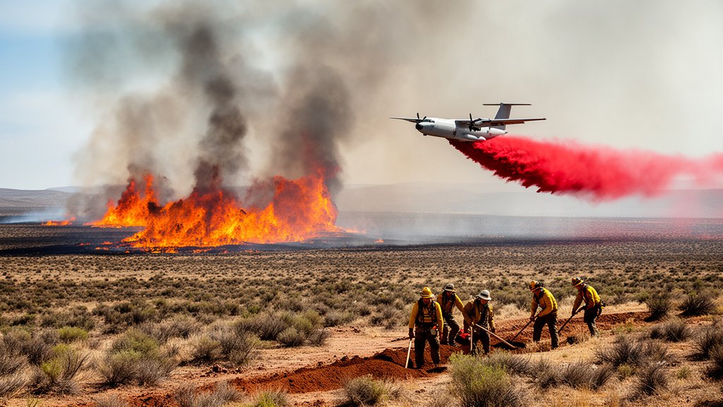
The Big Grass Fire has solidified its position as one of the most destructive and expansive rangeland infernos in recent memory, scorching 500,000 acres of terrain straddling the Oregon-Idaho border. As the blaze continues to rage, the tactical response from regional firefighters, federal land managers, and local ranching communities has evolved into a round-the-clock struggle against high-desert conditions that threaten to decimate local agricultural infrastructure and centuries-old cattle operations. The fire, characterized by explosive growth and erratic wind patterns, has tested the limits of regional containment strategies and mobilized a multi-agency response team focused on asset protection and line construction in some of the most remote, difficult-to-access geography in the American West.
Key Highlights
- Unprecedented Scale: The fire has consumed over 500,000 acres, creating a massive perimeter that demands complex resource allocation across two states.
- Strategic Threat: The blaze is directly endangering agricultural land and critical cattle ranching infrastructure, threatening the primary economic engine of the region.
- Tactical Complexity: Crews are employing a combination of aggressive aerial suppression, hand-dug firelines, and strategic back-burning to manage the fire’s progression through rugged, high-desert sagebrush.
- Multi-Agency Coordination: The operation involves a specialized mix of Bureau of Land Management (BLM) crews, local Rangeland Fire Protection Associations (RFPAs), and interagency wildland firefighters.
The Anatomy of a Rangeland Mega-Fire
The sheer scale of the Big Grass Fire presents a unique set of challenges that differ significantly from timber-dominated wildfires. In this high-desert environment, the primary fuel is sagebrush and invasive grasses, which dry out rapidly under the intense summer sun. These fine fuels allow the fire to travel at speeds that frequently outpace ground crews, turning miles of pasture into ash in a matter of hours. The 500,000-acre footprint is not merely a number; it represents a tactical nightmare for incident commanders who must prioritize the protection of life and agricultural assets in a vast, sparsely populated landscape.
Tactical Challenges in High-Desert Combat
One of the most significant hurdles for the unified command is the lack of natural breaks in the topography. Unlike forest fires where crews can utilize rock formations or clearings, the Big Grass Fire is moving through an uninterrupted, rolling landscape of combustible brush. Containment lines must be cut manually or with heavy equipment, often under extreme heat conditions where temperatures regularly exceed 100 degrees Fahrenheit. The logistical difficulty of moving water tenders and crews across remote, unpaved ranch roads further exacerbates the timeline for containment. Every hour of delay increases the probability of the fire spotting—where embers are carried by wind to ignite new patches of fuel ahead of the main front—creating a “leapfrog” effect that demands constant re-evaluation of defensive perimeters.
The Human and Economic Cost
While the acreage provides the headline, the reality for local communities is measured in the loss of grazing allotments, fencing, and livestock. Cattle ranching is the backbone of the economy along the Oregon-Idaho border, and the destruction of thousands of acres of forage effectively shuts down operations for the season, if not longer. Beyond the immediate loss of feed, the destruction of miles of perimeter fencing creates a severe livestock management crisis. Ranchers are being forced to organize emergency gathers to move herds away from the advancing fire line, often requiring split-second decisions that pit the safety of their livestock against the safety of their families and employees. The long-term economic recovery will require massive investments in infrastructure repair and land rehabilitation, a process that can take years, if not decades.
Integrating Aerial and Ground Assets
The battle against the Big Grass Fire relies heavily on a symbiotic relationship between air and ground support. Aerial tankers, including Very Large Air Tankers (VLATs) and Single Engine Air Tankers (SEATs), are deployed to drop fire retardant in critical locations, creating artificial barriers to slow the fire’s momentum. However, air support is only a stopgap. Ground crews, often comprised of “hotshot” teams and local volunteers from the RFPAs, are the only force capable of “cold trailing”—literally feeling for heat in the soil to ensure a fire is fully extinguished. The coordination required to sync aerial drops with ground-level line construction is a precision exercise in communication, necessitating clear radio channels and constant surveillance from reconnaissance aircraft overhead.
The Future of Fire Prevention
As fires like the Big Grass event become more frequent, policymakers and land managers are increasingly looking at proactive mitigation strategies. This includes the creation of fuel breaks, the management of invasive species like cheatgrass—which acts as a volatile accelerant—and the use of prescribed burning during cooler, wetter months. Experts argue that until the landscape is “re-engineered” to be more resilient through proactive vegetation management, events of this magnitude will remain a recurring, and perhaps unavoidable, hazard of life in the arid West. The ongoing fight serves as a grim but necessary reminder of the need for sustained funding for federal land agencies and continued support for the volunteer associations that remain the first line of defense in rural communities.
FAQ: People Also Ask
Q: What is the primary cause of the Big Grass Fire?
A: While investigations are ongoing, fires in this region are often ignited by a combination of lightning strikes, human activity, and the volatility of invasive dry grasses which ignite easily during high-heat events.
Q: Why is this fire so difficult to contain?
A: The size (500,000 acres), the rapid spread of invasive grasses, and the rugged, remote terrain make it extremely difficult to establish and hold containment lines compared to forest fires.
Q: How are ranchers coping with the loss of grazing land?
A: Many are working with local and federal agencies to relocate herds to emergency pasture, but the loss of thousands of acres of forage presents a long-term economic hardship that will require state and federal recovery aid.
Q: Are there evacuations currently in place?
A: Yes, mandatory and voluntary evacuation orders are constantly shifting based on the fire’s perimeter; residents are urged to monitor their local sheriff’s department and BLM field office alerts for real-time updates.