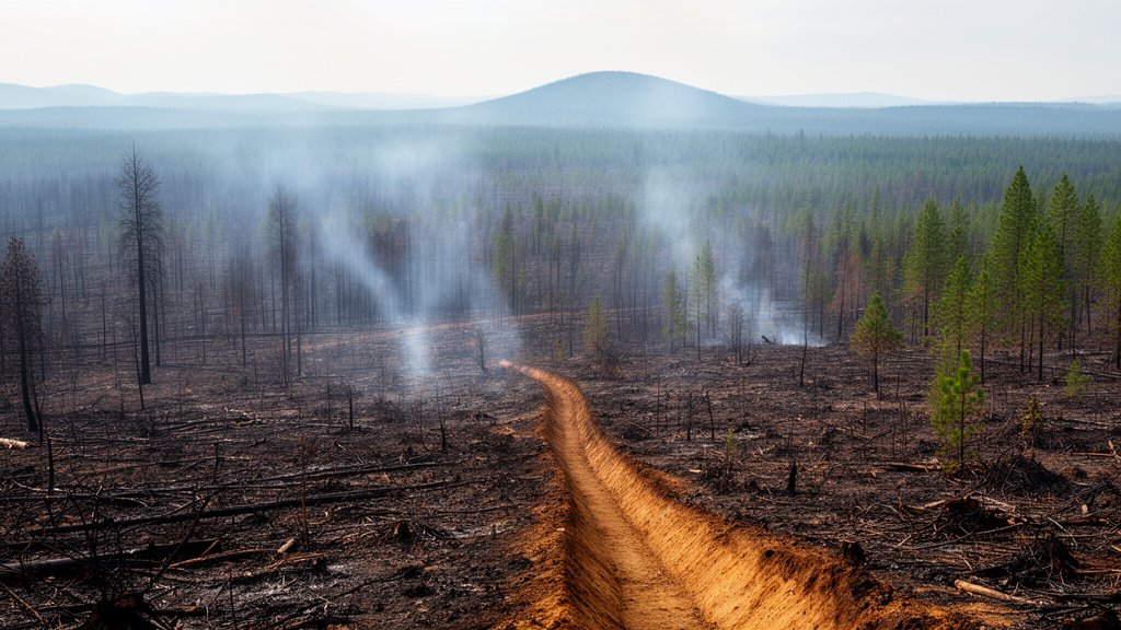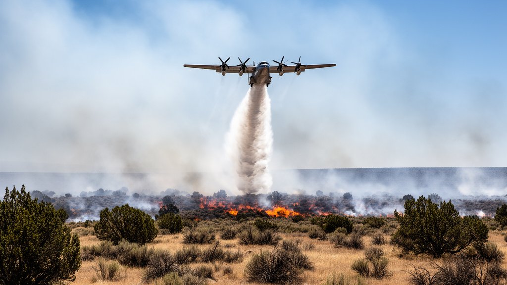
On July 21, the serenity of the high desert along the Malheur-Baker County line was violently interrupted as a cluster of nine wildfires erupted across the arid landscape. Collectively designated the ‘Cow Camp Complex,’ these fires represent a significant escalation in wildfire activity in Eastern Oregon, testing the resources of federal and local fire crews. The largest of the group has already consumed an estimated 2,000 acres, prompting an immediate mobilization of aviation assets and ground suppression teams to contain the blaze before the erratic summer winds turn the situation catastrophic.
Key Highlights
- Simultaneous Ignition: Nine distinct fire starts occurred in close proximity on July 21, necessitating the ‘Complex’ designation to streamline incident management.
- Significant Footprint: The largest fire within the complex is currently mapped at 2,000 acres, though the total affected acreage across the complex remains fluid as containment efforts proceed.
- Multi-Agency Response: Operations include critical aerial support and ground coordination between the Bureau of Land Management (BLM) Vale District and local Rangeland Fire Protection Associations (RFPAs).
- Investigation Ongoing: Officials have confirmed that the cause of the Cow Camp Complex is currently under investigation, a standard but crucial step in determining whether human activity or environmental factors triggered the cluster.
The Battle for the Rangelands: Inside the Cow Camp Complex
The ignition of the Cow Camp Complex serves as a stark reminder of the vulnerability of the Malheur and Baker County border regions. Unlike forested mountainous terrain, the high desert environment—characterized by sagebrush, cheatgrass, and juniper—is a literal tinderbox during the height of the summer. Fires in this region behave with terrifying speed. Because the fuel loads (grasses) are fine and continuous, once ignited, these fires can travel across hundreds of acres in a matter of minutes, driven by thermal updrafts and the notorious erratic winds of Eastern Oregon.
Anatomy of a Multi-Front Incident
When nine fires break out simultaneously or in rapid succession, the incident command structure undergoes a fundamental shift. Managing these as a ‘Complex’ is a strategic necessity. It allows incident commanders to pool limited resources—such as heavy air tankers, smokejumpers, and fire engines—across a centralized command post rather than attempting to fight nine separate wars on nine separate fronts.
The 2,000-acre lead fire within the complex is the primary focus of the operation. This is likely the fire with the greatest potential for containment breach or the one posing the highest threat to critical infrastructure, such as power transmission lines or historical grazing allotments. Incident command teams are currently prioritizing ‘anchor points,’ natural barriers like roads or rocky outcroppings where ground crews can safely engage the fire line.
Tactical Suppression in the Vale District
The Vale District of the Bureau of Land Management (BLM) is a massive jurisdiction, and managing such a sprawling area requires a unique cooperation model. One of the most effective tools in the Eastern Oregon wildfire arsenal is the Rangeland Fire Protection Association (RFPA). These associations consist of local ranchers and landowners who are trained, equipped, and legally authorized to fight fires on federal and private land.
In the case of the Cow Camp Complex, the speed at which these local assets arrived on the scene is as critical as the arrival of federal aviation resources. While air tankers provide the ‘knockdown’ power—dropping retardant to cool the active flames—the RFPAs and BLM engine crews provide the ‘mopping up’ and line-holding capabilities. This synergy is essential. Aviation can stop the spread, but only boots on the ground can secure the perimeter and ensure that a 2,000-acre fire doesn’t reignite from a smoldering root or ember.
The Ecological and Economic Stakes
Beyond the immediate threat to life and safety, the Cow Camp Complex carries heavy long-term implications. Malheur County is deeply reliant on its rangelands for cattle grazing and agriculture. A 2,000-acre burn in a localized area can wipe out grazing permits for the remainder of the season, forcing ranchers to purchase expensive supplemental feed or relocate herds.
Furthermore, the ecology of the Great Basin is fragile. These lands are prone to invasive species like cheatgrass, which thrives in fire-disturbed soil. If the burn is not managed correctly, the land may become even more fire-prone in the years to come, creating a vicious cycle of ecological degradation. The investigation into the fire’s cause is therefore not just a bureaucratic procedure; it is a vital part of land management, helping agencies understand whether mitigation strategies—such as fuel breaks or better public access controls—need to be adjusted for the next fire season.
As the sun sets over the Malheur-Baker border, the glow from the Cow Camp Complex remains a visible indicator of the precarious balance of the high desert. With aviation assets continuing to cycle through the area and ground crews working through the night, the immediate goal remains containment. However, the event serves as a bellwether for the rest of the summer: in a landscape this dry, preparedness is the only defense against the inevitable.
FAQ: People Also Ask
Q: What does it mean when wildfires are called a ‘Complex’?
A: In wildfire management, a ‘Complex’ is an incident management designation used when two or more individual fires are burning in close proximity. By managing them under one incident command, authorities can efficiently share resources like firefighting aircraft, crews, and supplies, which maximizes effectiveness.
Q: How do firefighting aviation assets work in this region?
A: Aviation assets, such as heavy air tankers or SEATs (Single Engine Air Tankers), drop fire retardant ahead of the fire line. The retardant is a chemical mixture that coats vegetation and inhibits combustion. In open rangelands like Malheur County, these drops are crucial for slowing fire spread enough for ground crews to establish containment lines.
Q: Why is it difficult to determine the cause of these fires?
A: Wildfires in remote, arid regions are often difficult to investigate due to the destruction of evidence by the fire itself. Investigators must analyze the ‘point of origin’ for ignition sources—such as lightning strikes, vehicles, target shooting, or equipment malfunction—but the vast, rugged terrain often makes reaching these sites in the immediate aftermath challenging.
Q: Are there evacuations associated with the Cow Camp Complex?
A: While official evacuation status changes hourly, residents and visitors in the Northern Malheur and Baker County areas should monitor the BLM Vale District and County Sheriff social media pages for real-time updates. Always heed official orders from local authorities immediately if asked to leave the area.