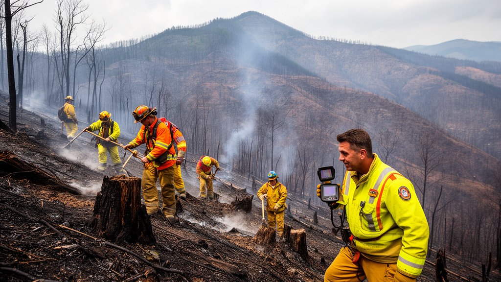
Firefighters have made significant strides against the Fielder Mountain Fire, successfully establishing containment lines around 75% of the 550-acre blaze. The incident, which ignited between last Thursday and Friday, has presented a persistent threat to the Rogue River region. While containment metrics have improved drastically from initial reports, active evacuation orders remain in effect as crews transition from aggressive suppression to mop-up and monitoring operations to ensure the safety of surrounding communities.
Key Highlights
- Containment Progress: Official reports confirm 75% containment of the 550-acre fire perimeter.
- Operational Timeline: The fire ignited between Thursday and Friday, prompting an immediate interagency response.
- Ongoing Safety Measures: Despite containment gains, active evacuation orders remain in place near the Rogue River to protect local residents.
- Tactical Focus: Incident command teams are currently prioritizing the mitigation of remaining hot spots within the containment lines.
Strategic Containment Amidst the Rogue River Landscape
The Fielder Mountain Fire has tested the tactical resolve of regional fire management teams. With the blaze consuming roughly 550 acres of dense, volatile vegetation, the speed of the initial response was critical to preventing further expansion toward the Rogue River corridor. The progression from an initial, low-percentage containment status to the current 75% threshold represents a pivotal shift in the trajectory of this incident. This success is primarily attributed to the establishment of firm firelines—gaps in vegetation meant to starve the fire of fuel—and the deployment of both ground crews and aerial resources to cool the interior of the fire.
The Mechanics of Mop-Up Operations
With 75% of the fire line now secured, the operational focus shifts to “mop-up.” This phase is often the most labor-intensive, requiring firefighters to systematically grid the area. Crews utilize hand tools, chainsaws, and hoses to locate and extinguish hot spots—smoldering roots, logs, or stumps that could easily reignite if wind conditions shift. In the rugged, undulating terrain surrounding Fielder Mountain, this process is particularly hazardous. Firefighters must navigate uneven slopes while ensuring that no “reburn” potential remains near the established containment line. Thermal imaging technology is being deployed by ground teams to identify infrared signatures of heat that remain invisible to the naked eye.
Navigating the Evacuation Threat
Despite the containment milestone, the evacuation orders currently in place serve as a stark reminder of the lingering risks. Evacuation zones are not lifted immediately upon achieving high-percentage containment; they remain in effect until Incident Commanders are certain that the risk to life and property has dropped to near-zero. Residents in the Rogue River area are advised to remain vigilant. The decision to maintain these orders is strategic, accounting for the potential of “spotting,” where wind carries embers outside the main fire area, creating new, smaller fires. By keeping the area clear, emergency vehicles can maneuver without obstruction, and public safety is prioritized over the desire for an immediate return.
Secondary Angles: Resilience and Risk Management
1. Ecological Restoration and Soil Stability: As the fire transitions to a controlled state, the focus shifts to the long-term health of the affected 550 acres. High-intensity fires can alter soil composition, creating hydrophobic (water-repellent) layers that increase the risk of future landslides or erosion during the rainy season. Experts are already assessing the need for aerial seeding or erosion barriers to protect the Rogue River watershed.
2. Interagency Coordination Dynamics: The response to the Fielder Mountain Fire highlights the complexity of modern wildfire suppression. The cooperation between the Oregon Department of Forestry, local fire districts, and potential support from the Bureau of Land Management is essential. These entities operate under a unified command structure that allows for the seamless integration of disparate resources, including volunteer departments and state-level specialized crews.
3. Climate Trends and Fire Behavior: Historical data for the Rogue River region indicates a shifting pattern in fire behavior. With earlier onset of fire seasons and more pronounced drought cycles, “traditional” containment strategies are being re-evaluated. The Fielder Mountain incident serves as a case study for the effectiveness of rapid, overwhelming force (the ‘initial attack’ strategy) in preventing smaller blazes from escalating into mega-fires that require weeks of suppression.
FAQ: People Also Ask
Q: What does 75% containment actually mean for my safety?
A: Containment refers to the percentage of the fire perimeter that has a line built around it, which is expected to hold. It does not mean 75% of the fire is extinguished. Evacuation orders remain until officials are confident the fire is fully stable and no longer a threat to the community.
Q: Why are evacuation orders still in place if the fire is mostly contained?
A: Safety protocols require that an area be entirely free of heat sources and stable before residents are allowed to return. There is a risk of flare-ups, falling trees (snags), or dangerous air quality, which necessitates keeping the zone clear for emergency response teams.
Q: How do firefighters determine when a fire is fully contained?
A: Containment is declared when a continuous line has been constructed around the fire perimeter, and crews have verified there is little to no risk of the fire crossing that line. This is verified by ground patrols and aerial thermal mapping.
Q: How can I track future updates for the Fielder Mountain Fire?
A: Residents should monitor official social media channels for the local fire district, the Oregon Department of Forestry, and local county sheriff websites for real-time changes to evacuation levels.