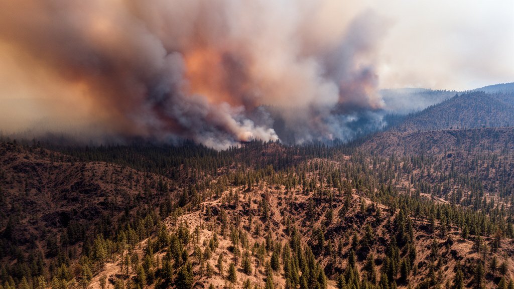
The landscape of Central Oregon is currently gripped by a harrowing wildfire emergency, as shifting winds and parched conditions have caused the Bench Fire and several concurrent blazes to surge out of control. With confirmed home losses already reported and thousands of residents under mandatory ‘Go Now’ evacuation orders, the region is facing one of its most challenging fire seasons in recent memory. Emergency management agencies, including the Deschutes County Sheriff’s Office and the U.S. Forest Service, have pivoted to a crisis footing, prioritizing life-safety operations as the fires tear through volatile, drought-stricken terrain.
Key Highlights
- Mass Displacement: Thousands of residents remain under active Level 3 ‘Go Now’ evacuation orders, with emergency shelters at capacity.
- Structural Destruction: Official confirmation has been provided regarding the loss of primary residences; damage assessment teams are still unable to reach the hardest-hit zones.
- Strained Resources: Regional firefighting capacity is at its limit, with state and federal agencies coordinating to pull in additional aerial assets and ground crews.
- Air Quality Alert: The Oregon Department of Environmental Quality has issued hazardous air quality alerts for large swaths of the region, complicating evacuation logistics.
The Unfolding Crisis in the High Desert
The current wildfire outbreak in Central Oregon represents a complex convergence of environmental stressors and topographical challenges. While the Bench Fire has garnered significant public attention due to its proximity to residential areas, it is merely one component of a larger, regional conflagration. The fire behavior has been described by incident commanders as ‘highly aggressive,’ driven by a combination of low relative humidity, record-high temperatures, and heavy fuel loads—dead and dry vegetation that has accumulated over several years of drought.
Tactical Challenges for Firefighters
Firefighting operations are currently dictated by the erratic nature of the flames. Incident Command posts report that traditional fire breaks are being overrun by spot fires, which are ignited by embers carried ahead of the main fire front by gusty winds. This phenomenon, known as ‘spotting,’ makes containment extremely difficult. Furthermore, the steep and inaccessible terrain of the region complicates the deployment of heavy ground equipment, forcing agencies to rely heavily on aerial suppression tactics. However, even aerial operations have faced interruptions due to dense smoke coverage, which limits visibility for pilots navigating these challenging mountain corridors.
The Human Toll: Evacuation and Resilience
The most pressing concern for authorities remains the evacuation process. For thousands of citizens, the reality of living in the wildland-urban interface—a zone where human development meets undeveloped wildland—has shifted from a theoretical risk to a tangible, life-altering event. Coordination between local law enforcement, the American Red Cross, and local volunteer organizations has been critical in facilitating the movement of residents. Shelters have been established in nearby municipalities that are currently out of the fire’s path, providing essential supplies, medical support, and psychological counseling for those displaced by the fires.
Climate Factors: A New Normal?
While wildfires are a natural component of Oregon’s ecosystem, climatologists and fire ecologists point to this specific series of events as symptomatic of a shifting climate reality. The ‘New Normal’ is characterized by longer, hotter, and drier summers that effectively lengthen the fire season by several weeks. This extended window of volatility means that the vegetation has less time to recover from drought, creating a continuous cycle of flammability. The intensity of this year’s fires, characterized by rapid rates of spread, aligns with modeling data that suggests extreme fire weather events will become more frequent in the Pacific Northwest.
Economic and Recreational Impact
The economic fallout of these wildfires is substantial and far-reaching. Central Oregon relies heavily on its outdoor recreation and tourism economy, which is currently paralyzed. National forests, trails, and recreation areas that typically draw thousands of tourists during the peak of summer are now closed for safety. Beyond tourism, the damage to local infrastructure—including power lines, telecommunications towers, and roadway networks—presents a long-term economic challenge. Once the fires are contained, the focus will shift to the arduous task of damage assessment and remediation. The financial burden of insurance claims, reconstruction, and environmental restoration is expected to persist long after the smoke clears.
FAQ: People Also Ask
Q: How can residents stay updated on the latest evacuation zones?
A: Residents should monitor official updates from the Deschutes County Sheriff’s Office and the Oregon Department of Emergency Management. Utilize resources like the ‘Watch Duty’ app or local news channels, which provide real-time mapping of evacuation orders.
Q: What does a ‘Level 3: Go Now’ evacuation order mean?
A: A Level 3 order means there is immediate and imminent danger to life. Residents are urged to leave their homes immediately, take only essential items, and follow designated evacuation routes without delay. Do not wait to pack; authorities may not be able to assist if conditions worsen.
Q: How do fires like the Bench Fire affect long-term forest health?
A: While fire is natural, the high-intensity ‘stand-replacing’ fires observed this season can sometimes lead to forest conversion, where forests struggle to regenerate into their original species composition. Forestry experts are currently studying the impact of these burns on soil nutrient levels and seed bank survival to determine if manual reforestation efforts will be necessary.