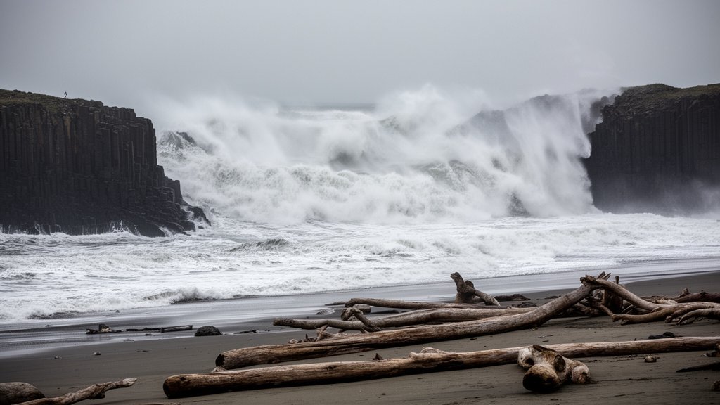
The National Weather Service (NWS) has issued an urgent, high-priority surf warning for the entire Oregon coastline, cautioning residents and visitors of an extreme threat posed by sneaker waves and massive breaking wave heights. With breakers projected to reach up to 35 feet, emergency management agencies are pleading with the public to maintain a significant distance from the shoreline as these turbulent conditions arrive.
Key Highlights
- Extreme Surf Warning: The National Weather Service reports breaker heights potentially reaching 35 feet, creating dangerous conditions for coastal regions.
- Sneaker Wave Danger: An extreme threat of sneaker waves—sudden, unpredictable surges of water that travel much further up the beach than expected—is in effect.
- Emergency Protocols: Authorities, including the U.S. Coast Guard and Oregon Parks and Recreation Department (OPRD), strongly advise beachgoers to stay off jetties and away from logs, which can be easily moved by the tide and cause severe injury.
- Hazardous Timing: These conditions are exacerbated by high tides and strong current surges, significantly narrowing the buffer zone between the ocean and dry land.
The Unpredictable Fury of the Pacific
The Oregon coastline is renowned for its rugged, scenic beauty, characterized by basalt cliffs, sandy dunes, and dense forests. However, this geography also serves as a funnel for the immense kinetic energy of the Pacific Ocean. When the National Weather Service issues a high surf warning, it is not merely a suggestion; it is a critical notification regarding the physics of the nearshore environment. A 35-foot breaker is not a static wave; it is a massive volume of water moving with immense velocity, capable of exerting tons of pressure upon impact.
Understanding the Sneaker Wave Phenomenon
Unlike typical tidal shifts or predictable wind-driven surf, sneaker waves are elusive and lethal. They are generated by long-period swells—a result of storms far out in the Pacific Ocean that travel thousands of miles. Because these waves have a long “period” (the time between crests), they can strike with little warning. A beach that appears safe one moment can be inundated by a violent surge of water just minutes later. This phenomenon is particularly deceptive during calm-looking conditions, leading visitors to believe they are safely away from the surf line.
The Role of Atmospheric and Oceanographic Monitoring
The National Weather Service utilizes an intricate network of data to predict these events. This includes information from the National Data Buoy Center (NDBC), which monitors swell height, wave period, and direction. When data indicates that long-period swells are aligning with coastal shallowing, the NWS issues these urgent warnings. It is a complex process of translating deep-ocean telemetry into actionable safety guidance for the public. The 35-foot breaker height is a specific, calculated projection that represents the potential impact zone, meant to force local authorities to cordon off high-risk beach areas.
Strategic Safety and Emergency Management
When these warnings are active, the Oregon Parks and Recreation Department and the U.S. Coast Guard shift into a heightened state of readiness. The primary directive issued to the public is to “never turn your back on the ocean.” This mantra is essential because, in the time it takes to look away, a sneaker wave can rapidly advance over the high-tide line, dragging unsuspecting individuals or heavy driftwood into the surf.
The Danger of Coastal Debris
A frequently overlooked hazard during these events is the movement of large driftwood logs. On the Oregon coast, these logs can weigh several tons. When caught in the path of a 35-foot breaker or a powerful sneaker wave, these logs act like battering rams. They are capable of inflicting life-threatening injuries upon impact, turning a beach stroll into a survival scenario in an instant. The U.S. Coast Guard emphasizes that during high surf advisories, the beach is not a place for recreation, and even the most experienced surfers and beachgoers are at extreme risk.
Long-Term Coastal Dynamics and Climate Factors
Beyond the immediate threat, these events highlight the dynamic nature of the Pacific Northwest coastline. Climate factors and changing ocean temperatures contribute to the frequency and intensity of these high-energy swell events. Historians and coastal geologists note that the Oregon coast is in a constant state of flux, where erosion and accretion patterns are heavily dictated by these severe weather cycles. While individual warnings address the immediate danger, they also underscore the reality of the Pacific Ocean as an untamed, powerful force that dictates the safety and economic viability of coastal tourism.
FAQ: People Also Ask
1. What exactly is a sneaker wave?
A sneaker wave is a sudden, powerful surge of water that travels much further up the beach than the waves that preceded it. They occur without warning and are caused by long-period swells, making them extremely difficult to predict even for experienced beachgoers.
2. How should I react if I see the ocean suddenly surging?
Do not attempt to run back towards the water or try to salvage personal belongings. Move to higher ground immediately and stay clear of the surf line. If you are swept into the water, try to stay afloat and conserve energy, but prioritize staying out of the water at all costs.
3. Why are 35-foot breakers considered so dangerous?
At 35 feet, a wave contains massive kinetic energy. Aside from the force of the water itself, these waves can pick up heavy debris, such as logs and boulders, turning the surf zone into a violent, chaotic environment where survival is unlikely.
4. Where can I check the latest NWS warnings?
For the most accurate and up-to-the-minute data, monitor the National Weather Service website specifically for the Portland or Medford offices, which cover the Oregon coast, or check the Oregon Parks and Recreation Department’s official social media channels for real-time beach closures.