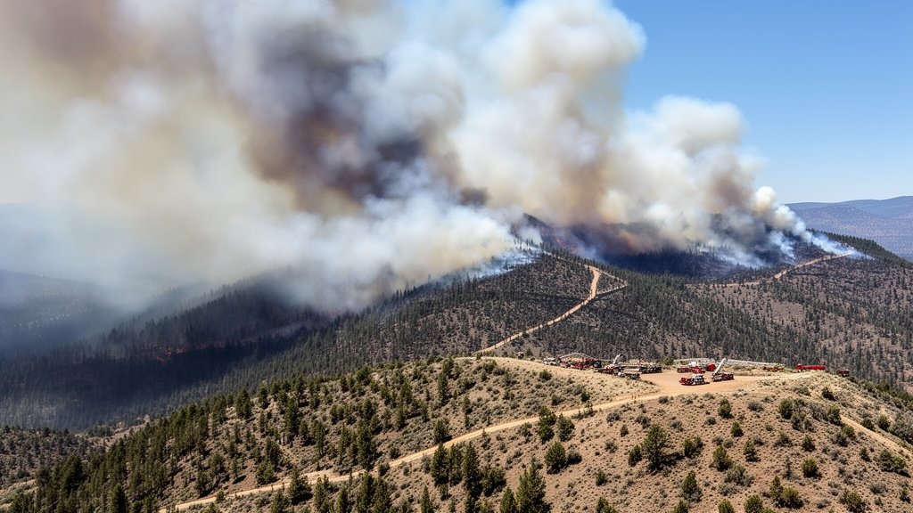
The Bench Fire, currently raging near the Warm Springs reservation, has surged to a staggering 45,209 acres as of July 28, 2026. With containment remaining at 0%, the wildfire has triggered a complex and large-scale unified command response. Federal and state incident management teams are working in tandem to combat the inferno, which poses a significant threat to critical infrastructure, tribal land, and local ecosystem health. The situation is evolving rapidly as crews navigate challenging terrain and severe weather conditions that have accelerated the fire’s growth over the last 48 hours.
Key Highlights
- Total Acreage: The Bench Fire has expanded to 45,209 acres.
- Containment Status: 0% containment reported, signaling an active and volatile situation.
- Command Structure: A Unified Command has been established, integrating the Bureau of Indian Affairs (BIA), Oregon Department of Forestry (ODF), and federal partners.
- Primary Threat: The fire poses immediate risks to regional critical infrastructure and local cultural sites.
- Operational Difficulty: Extreme fire behavior and difficult topography continue to hamper direct suppression efforts.
The Crisis on the Plateau: Evaluating the Bench Fire Response
The Bench Fire has rapidly transformed into one of the most critical incidents in Central Oregon’s 2026 wildfire season. By noon on July 28, the fire’s footprint reached 45,209 acres, a result of erratic winds and dry, fuel-heavy vegetation that characterizes this region of the Warm Springs plateau. The absence of any containment lines is a stark indicator of the fire’s intensity, forcing incident commanders to pivot from direct suppression to an aggressive defensive strategy aimed at asset protection.
The Unified Command: A Multi-Agency Strategic Necessity
At the heart of the response is the Unified Command, a strategic collaboration essential for managing wildfires that cross complex jurisdictional boundaries. Because the Bench Fire is impacting land managed by the Confederated Tribes of Warm Springs alongside neighboring federal and state jurisdictions, the command structure must integrate resources from the Bureau of Indian Affairs (BIA), the Oregon Department of Forestry (ODF), and specialized federal incident management teams.
This unified approach allows for the seamless sharing of assets, including heavy air tankers, ground crews, and logistical support. By centralizing decision-making, the command aims to optimize the deployment of limited firefighting personnel across a vast, rugged landscape. However, the sheer scale of the fire—now exceeding 45,000 acres—stretches these resources to their limit, requiring constant re-evaluation of priorities.
Climate and Terrain: The Perfect Storm
July 2026 has been marked by persistent high-pressure systems that have baked the soil and depleted fuel moisture levels to historic lows. The Bench Fire is burning through a mix of juniper, sagebrush, and timber, which serves as high-intensity fuel when exposed to the sustained, hot winds that have been present since the fire’s ignition.
Topography is another critical factor. The landscape surrounding Warm Springs is defined by canyons and steep ridges, which often create “chimney effects,” where heat and smoke are funneled upward, drastically increasing the rate of spread. This terrain is notoriously difficult for ground crews to navigate, limiting the effectiveness of traditional containment lines and necessitating an increased reliance on aerial resources for fire retardation.
The Socio-Economic and Cultural Impact
Beyond the immediate threat to public safety, the Bench Fire represents a significant blow to the local economy and cultural heritage. The Warm Springs reservation is home to extensive tribal lands that hold deep historical and cultural value. The destruction of these landscapes is not merely an economic issue but a loss of irreplaceable natural heritage. Furthermore, the smoke plumes have triggered health warnings across the region, impacting regional air quality and disrupting agricultural operations, transportation networks, and tourism—all of which are vital components of the Central Oregon economic engine.
Future Outlook: Challenges to Containment
As incident commanders look toward the next 72 hours, the primary objective remains identifying and protecting critical infrastructure. Containment efforts are hampered by the unpredictable nature of the fire’s flanks, which continue to push into new, unburned fuel. Fire modeling suggests that unless a significant shift in humidity occurs, the fire will continue to challenge containment attempts.
Crews are currently focusing on “indirect tactics,” including the construction of firebreaks along key roadways and the implementation of burnout operations to remove fuel from the fire’s path. While these tactics are resource-heavy, they are essential to preventing further uncontrolled expansion into vulnerable populated areas. The public is advised to monitor local alerts from the Central Oregon Fire Information portal for updates on evacuations and road closures.
FAQ: People Also Ask
1. What is the current containment percentage of the Bench Fire?
As of July 28, 2026, the Bench Fire is reported to have 0% containment. This is a dynamic situation, and teams are actively working to establish secure lines.
2. Which organizations are involved in the Unified Command?
The response is being managed under a Unified Command that includes the Bureau of Indian Affairs (BIA), the Oregon Department of Forestry (ODF), and other state and federal partners to synchronize suppression efforts across jurisdictional boundaries.
3. Is there a threat to infrastructure in the area?
Yes, protecting critical infrastructure is a primary objective for the incident management teams, who are prioritizing the defense of roads, utility assets, and cultural sites within the affected area.
4. Where can I find official evacuation notices?
Residents and visitors should refer to official Central Oregon Fire Information channels and local sheriff’s department alerts for the most accurate and up-to-date evacuation orders and emergency protocols.