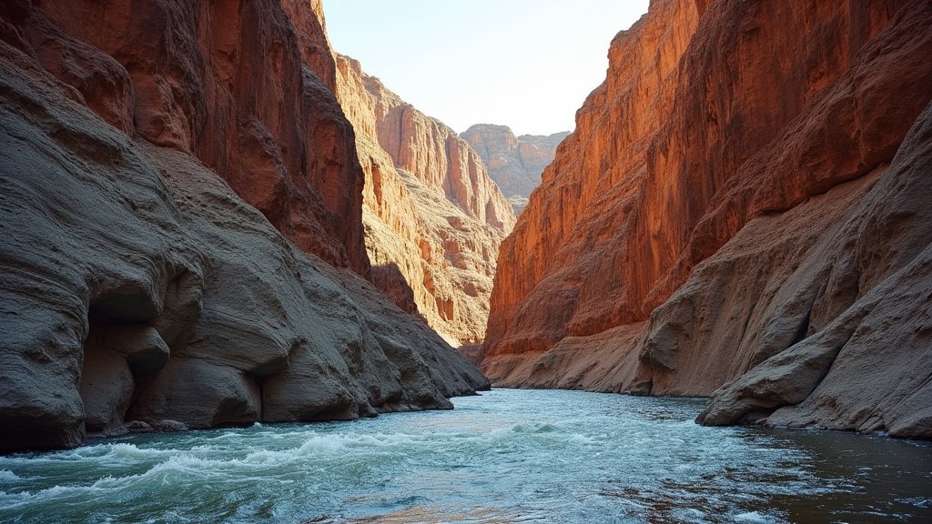
A geologist’s recent float trip down Oregon’s John Day River has offered an unparalleled, firsthand journey through 40 million years of Earth’s history, etched into the ancient rock formations lining the waterway. This unique expedition provided an intimate look at the region’s geological past, revealing a rich tapestry of volcanic activity, shifting climates, and ancient ecosystems.
Key Highlights:
- A geologist explored 40 million years of geological history via a float trip on the John Day River.
- The expedition highlighted the river’s role in exposing ancient rock layers.
- The journey offered insights into Oregon’s volcanic past and changing environments.
- This unique adventure serves as a living classroom for understanding geological time.
Unearthing Eons on the John Day River
The John Day River, winding through the high desert of eastern Oregon, is renowned not just for its scenic beauty but also as a treasure trove of paleontological and geological wonders. This particular journey, undertaken by a dedicated geologist, transformed a recreational float into an immersive field study. By navigating the river, the geologist was able to observe and interpret the stratigraphy – the layers of rock that tell a story of deposition, erosion, and geological change over millions of years. The exposed canyon walls act as a natural cross-section, revealing the dramatic shifts in Oregon’s environment, from ancient flood basalts to sedimentary deposits that hint at past climates and life forms.
A Chronicle in Stone
The rocks along the John Day River chronicle a dynamic history. The oldest layers speak of intense volcanic periods, evidenced by thick basalt flows and ash deposits. These events shaped the very landscape, creating the rugged terrain visible today. Moving upwards through the strata, geologists can find evidence of more temperate periods, indicated by sedimentary rocks that contain fossilized plant material and animal remains. These fossils provide crucial clues about the flora and fauna that once inhabited the region, offering a glimpse into ancient ecosystems that are vastly different from today’s high desert environment. The geologist’s float trip allowed for close examination of these layers, often inaccessible by foot, providing a unique perspective on the geological timescale.
The River as a Geological Agent
Beyond simply exposing the layers, the John Day River itself has played a significant role in shaping the geological narrative. Through millennia of erosion, the river has carved its path through the uplifted landscape, relentlessly cutting down and revealing the history buried within. The process of fluvial erosion is a powerful geological force, and the John Day River serves as a prime example of its long-term impact. Understanding the river’s course and its erosional power is key to interpreting the sequence and context of the rock layers it has uncovered. This constant interplay between rock formation and erosion creates a continuous geological story.
Paleontological Significance
The John Day Formation, a significant geological unit exposed along the river, is particularly famous for its fossil record. This formation has yielded a remarkable array of fossils, including those of ancient horses, rhinoceroses, camels, and various plant species. These discoveries have been instrumental in reconstructing the evolution of mammals and understanding past climatic conditions in North America. The geologist’s direct observation during the float trip can contribute to ongoing research by noting specific formations or potential fossil-bearing sites that might warrant further investigation. It underscores the importance of such natural laboratories for scientific discovery.
FAQ: People Also Ask
What makes the John Day River geologically significant?
The John Day River is geologically significant because its canyon walls expose a continuous sequence of rock layers, known as the John Day Formation, spanning approximately 40 million years. This formation contains a rich fossil record and showcases evidence of ancient volcanic activity and significant environmental changes in Oregon.
What kind of fossils can be found in the John Day Formation?
The John Day Formation is known for its exceptionally well-preserved fossils of mammals, including early horses, rhinoceroses, oreodonts, and camels. Plant fossils are also common, offering insights into the ancient flora of the region.
How does a river help geologists study rock layers?
Rivers act as natural erosional agents, cutting through landscapes over millions of years. This process exposes underlying rock strata that might otherwise be buried. Geologists can then study these exposed layers, or stratigraphy, to understand the geological history, including the sequence of rock formation, volcanic events, and changes in depositional environments.
What are the main geological periods represented by the rocks along the John Day River?
The rocks primarily represent the Oligocene and Miocene epochs of the Neogene Period, with some older Eocene and younger Pliocene formations also present. These periods are critical for understanding the evolution of mammals and the geological development of the Pacific Northwest.
Why is it called the John Day Formation?
The formation is named after the John Day River, as the most significant and comprehensive exposures of these unique rock layers are found along its banks and in the surrounding drainage basin in eastern Oregon.