Oregon’s coastline, perpetually vulnerable to the looming threat of a massive Cascadia Subduction Zone earthquake, remains in a state of critical infrastructure deficit. A comprehensive state analysis has exposed a harrowing reality: despite the high-risk categorization of the Pacific Northwest, only a single vertical evacuation structure currently exists to protect thousands of residents and tourists from the imminent threat of a catastrophic tsunami. As geologists and emergency planners warn that “The Big One” is not a matter of if, but when, the state’s inability to provide safe havens for its coastal population has become a glaring vulnerability that threatens to turn a natural disaster into a humanitarian crisis.
The Vertical Evacuation Gap: Can Oregon’s Coast Survive the Big One?
The Cascadia Subduction Zone, a 600-mile-long fault line stretching from Northern California to British Columbia, is capable of producing a magnitude 9.0 or greater earthquake. For coastal communities in Oregon, the ground shaking is only the first phase of a two-part catastrophe. The resulting tsunami—expected to arrive within 15 to 20 minutes of the seismic event—poses a lethal challenge: in many areas, natural high ground is geographically inaccessible within such a limited timeframe.
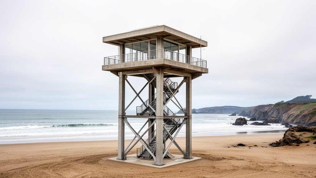
When roads are decimated by liquefaction and bridge collapses, vertical evacuation structures—essentially engineered towers or reinforced concrete buildings designed to withstand massive force—are the only lifeline for those unable to reach the hills. Currently, the Oregon Coast Aquarium in Newport hosts the state’s solitary vertical evacuation structure, a pilot project that has yet to be replicated with the urgency required to cover the hundreds of miles of high-risk shoreline.
The Engineering and Economic Impasse
The scarcity of these structures is not due to a lack of awareness, but rather a convergence of staggering engineering requirements and funding hurdles. Constructing a vertical evacuation tower is an immense undertaking; it must withstand not only the initial earthquake’s ground acceleration but also the tremendous lateral force of a tsunami surge, which is often laden with debris—cars, shipping containers, and parts of homes—that act as battering rams.
According to data from the Oregon Department of Geology and Mineral Industries (DOGAMI), the cost of retrofitting existing buildings or constructing purpose-built towers can run into the millions. Many coastal towns, characterized by small tax bases and seasonal tourism-dependent economies, simply cannot shoulder the capital expenditure required. While federal grants through FEMA are available, the competitive nature of these funds and the rigid, complex application processes often leave smaller municipalities at the back of the queue.
Geographies of Risk: The Inundation Problem
The “tsunami inundation zone” defines the geographic extent of the potential destruction. In communities like Cannon Beach, Seaside, and Lincoln City, the topography presents a paradoxical danger: the most popular, high-density areas for tourism are often located on low-lying sandy spits or river estuaries. These areas are the furthest from high ground, creating a race against time that thousands of visitors—who may not be familiar with tsunami evacuation routes—are unlikely to win.
Emergency planners argue that the current focus on “horizontal evacuation” (running to the hills) is insufficient. In places where the hills are two miles away, and the wave is 15 minutes out, horizontal evacuation is a death sentence. The lack of vertical structures in these high-density zones means that the current evacuation strategy relies on a “best-case scenario” that ignores the reality of debris-choked roads and human panic.
Historical Context and Future Predictions
Geological records confirm that the last “full-margin” rupture of the Cascadia Subduction Zone occurred on January 26, 1700. This event sent a tsunami across the Pacific that devastated Japan, leaving a clear “orphan tsunami” record in Japanese archives. Modern scientists, using tree-ring dating and marine core sampling, have determined that the recurrence interval for such events is roughly every 300 to 500 years. We are now well within the window of recurrence.
State officials acknowledge that while public awareness campaigns regarding tsunami “blue lines” (evacuation zone markers) have improved, public safety infrastructure has stalled. Without a massive injection of state and federal investment, Oregon’s coast remains a ticking clock. The focus is shifting toward incentivizing private developers to incorporate vertical evacuation designs into new hotels and residential complexes, but this approach remains voluntary rather than mandated by strict, safety-driven building codes.
As the state grapples with the financial realities of coastal protection, the overarching sentiment from seismic safety experts remains consistent: the current single-structure reality is insufficient. To survive the Big One, Oregon needs a paradigm shift that treats tsunami infrastructure not as a luxury amenity for specific sites, but as an essential utility for the entire coastal population.
FAQ: People Also Ask
1. Why is only one vertical evacuation structure built in Oregon?
Building these structures is incredibly expensive and requires complex engineering to withstand both high-magnitude earthquakes and massive tsunami waves. Lack of consistent funding and competing priorities for state budgets have prevented widespread implementation.
2. How long do people have to evacuate before a tsunami hits?
In the event of a Cascadia Subduction Zone earthquake, the first wave is expected to arrive within 15 to 20 minutes. This creates a critical window that makes horizontal evacuation impossible for residents and tourists in low-lying coastal areas.
3. Is there a plan to build more towers?
Yes, emergency planners and the DOGAMI continue to advocate for more structures. Current efforts are focused on integrating vertical evacuation capabilities into new developments and identifying key high-density locations that are prime candidates for future grant funding, though progress remains slow.
4. Why can’t we just rely on the hills for evacuation?
In many coastal towns, the geography is relatively flat, and the hills are located miles inland. Roads will likely be destroyed by the earthquake, making them impassable for vehicles. Pedestrian evacuation in the allotted 15-20 minutes is not feasible for many, including the elderly, children, or visitors unfamiliar with the terrain.