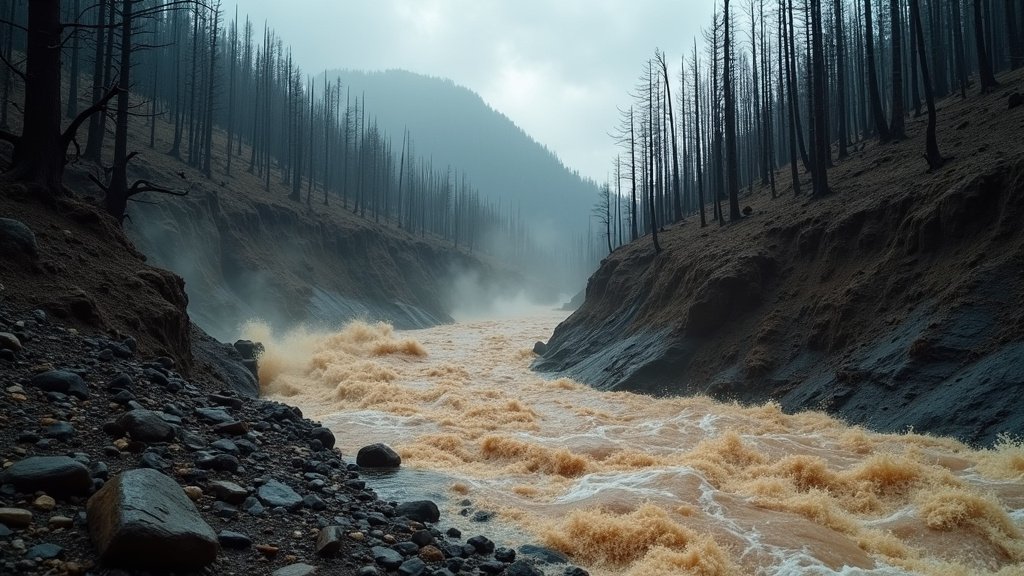
EASTERN OREGON – A significant portion of Eastern Oregon is under a Flash Flood Watch this Saturday, August 16th, 2025, as a rare late-summer storm funnels substantial moisture into the region. The National Weather Service (NWS) has issued the watch, warning residents in Baker, Harney, and Malheur counties, as well as the Oregon Lower Treasure Valley, of the potential for dangerous conditions.
Forecasters anticipate excessive rainfall, with thunderstorms capable of delivering rain rates of up to 1 inch per hour. This intense precipitation poses a serious risk of flash flooding in low-lying areas, urbanized street flooding, and particularly hazardous debris flows, especially in and around recent wildfire burn scars.
The Lingering Scar of Wildfires and Elevated Flood Risk
The increased threat of flash flooding and debris flows in Eastern Oregon is significantly amplified by the landscape’s susceptibility following wildfire events. Wildfires dramatically alter ground conditions, transforming normally absorbent soil into a water-repellent surface akin to pavement. [5, 13] The heat from a fire bakes the ground, severely reducing its ability to soak up water.
Consequently, even moderate rainfall can trigger rapid runoff in burned areas, leading to flash floods. [5, 13] The risk of these post-wildfire hazards can persist for two to five years after a fire, as vegetation regrowth, which helps stabilize soil and absorb moisture, is a slow process. [5, 13] When heavy rain combines with loose ash, soil, rocks, and burned trees on steep slopes, it can generate fast-moving, destructive debris flows capable of damaging or destroying culverts, bridges, roadways, and even buildings miles downstream from the burn scar. [4, 5, 16]
Eastern Oregon’s semi-arid soil and its landscape characterized by steep mountains and canyons further contribute to rapid water runoff during intense rain events, making it inherently prone to flash floods.
Areas Under Immediate Watch
The Flash Flood Watch is specifically in effect for a broad area across northeast and southeast Oregon, encompassing Baker County, Harney County, Malheur County, and the Oregon Lower Treasure Valley. The NWS advises that conditions remain favorable for flash flooding through Sunday evening. While localized heavy downpours within thunderstorms are the primary concern, the cumulative effect of the precipitation could lead to widespread issues.
Dangerous Deluge: Potential Impacts and Safety Advisories
The immediate implications of this watch are significant for residents and travelers across the affected regions. The Oregon Department of Transportation (ODOT) emphasizes the critical importance of checking road conditions via TripCheck.com before venturing out, as flooded roads are often closed for public safety. [7, 12] Driving through high water is exceptionally dangerous; as little as six inches of moving water can sweep a person off their feet, and a foot of water can carry away a vehicle. [9, 17] Officials universally advise the public to adhere to the crucial message: “Turn Around Don’t Drown.” [2, 3, 9]
Beyond direct flooding, the threat of debris flows remains a top concern, particularly for communities located below or downstream from recent wildfire perimeters. These can occur with little to no warning, transforming peaceful streams into raging torrents of mud and debris. [5, 13]
Official Response and Community Preparedness
The National Weather Service continues to monitor weather patterns closely, issuing timely updates. A Flash Flood Watch signifies that conditions are favorable for flooding, and while it does not guarantee a flood will occur, it necessitates heightened preparedness. A Flash Flood Warning, conversely, indicates that a flood is imminent or already happening, requiring immediate action. [20, 22]
The Oregon Department of Emergency Management (OEM) plays a vital role in coordinating response efforts and disseminating critical information. They urge all Oregon residents, especially those in affected areas, to take proactive steps to ensure their safety and the safety of their families. This includes building an emergency kit, having a family disaster plan, and planning evacuation routes. [2, 3, 6]
Residents are encouraged to stay informed through multiple channels, including NOAA Weather Radio and local media. Oregon also utilizes two primary emergency alert systems: the opt-in OR-Alert system and the automatic federal Wireless Emergency Alert (WEA) system, both of which can provide vital, location-specific warnings to cell phones.
An Unseasonable August Anomaly
This late-summer storm is considered unusual for August, a month typically characterized by dry conditions in the Pacific Northwest. AccuWeather meteorologists note that the system could bring rainfall amounts equal to or even exceeding the total rainfall expected for the entire month of August, with some areas potentially receiving up to 2 inches. While this moisture provides much-needed relief to drought-stricken parts of the state, the parched, hard-packed ground means that much of the heavy rain will run off quickly, contributing to the heightened flood risk.
Staying Vigilant Amidst Changing Weather Stories
As Eastern Oregon endures this period of heightened flood risk, sustained vigilance is paramount. The interplay of intense rainfall, vulnerable landscapes, and the unpredictable nature of thunderstorms means conditions can change rapidly. These top weather stories serve as a critical reminder of Oregon’s diverse and sometimes challenging natural environment.
Residents should continue to monitor official weather alerts, heed advice from emergency services, and be prepared to take immediate action if a Flash Flood Warning is issued. The safety of lives and property hinges on preparedness and quick, informed decisions during these potentially dangerous weather events.


