Understanding Atmospheric River Flooding in the Pacific Northwest
A powerful atmospheric river is currently unleashing widespread atmospheric river flooding across Washington and Oregon. This significant weather event began impacting the Pacific Northwest on December 7, 2025, and is expected to persist through December 11, 2025. National Weather Service offices in Portland and Seattle have issued widespread flood watches and warnings, highlighting a serious risk of riverine flooding and urban flooding. Landslide threats are also a major concern in steep terrain and burn-scarred areas, underscoring the danger of atmospheric river flooding.
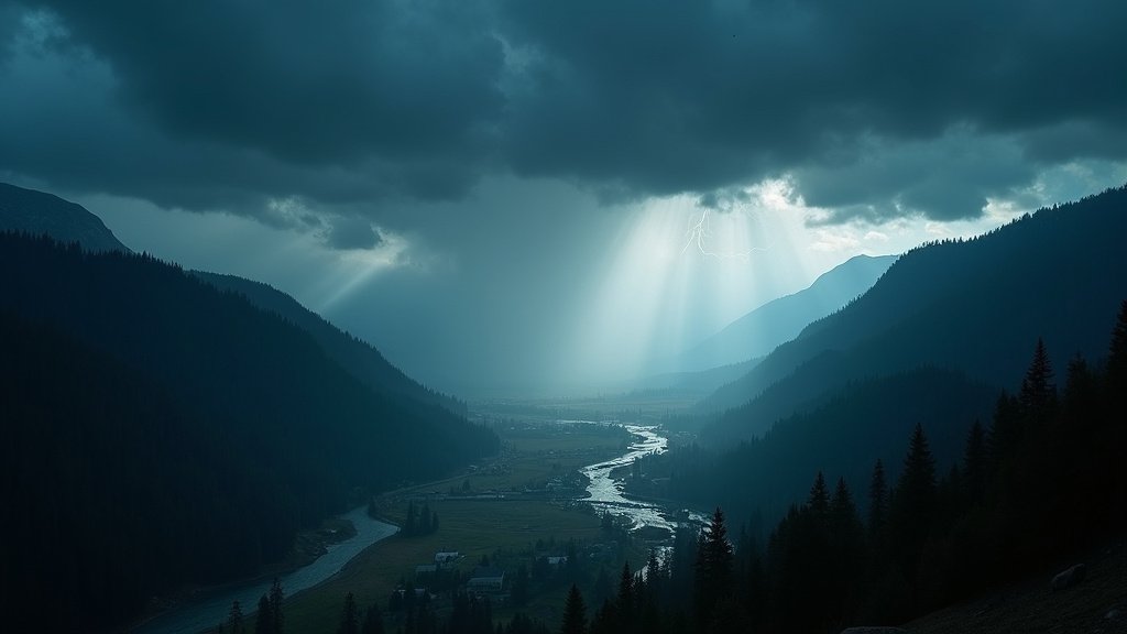
The Immense Power of the Atmospheric River
Atmospheric rivers are long, narrow corridors of concentrated water vapor, transporting vast amounts of moisture from the tropics toward the poles. When these systems make landfall, they can release torrents of rain and snow, especially when interacting with mountainous terrain, contributing to significant atmospheric river flooding. The current event is classified as a major atmospheric river, potentially reaching AR4 or AR5 intensity. This means it carries a significant moisture plume, and some models forecast this event to be among the strongest seen in early winter, comparable to storms that have historically altered precipitation totals.
Issuing Atmospheric River Warnings and Flood Watches
Flood watches and atmospheric river warnings are now in effect across western Washington and Oregon, spanning from late Sunday, December 7, through late Thursday, December 11, 2025. NWS Portland issued warnings for three specific rivers: the Wilson River near Tillamook, Oregon, and Johnson Creek in Clackamas and Multnomah Counties, Oregon. The Grays River near Rosburg, Washington, also has a warning. Flood watches cover large areas, including coastal counties and the Willamette Valley in Oregon, extending to southwest Washington and the Cascade foothills. For Washington, NWS Seattle issued a Flood Watch for western parts of the state, including the Olympic Peninsula and Puget Sound lowlands, valid through the afternoon of December 12, 2025.
Oregon Faces Significant Riverine Flooding
Oregon is particularly vulnerable to significant riverine flooding from this atmospheric river. The Wilson River near Tillamook is forecast to exceed flood stage on December 8, with moderate flooding expected along U.S. Highway 101 north of the Tillamook Creamery. Low-lying roads and pastures near the Wilson River could also flood. Johnson Creek is also expected to exceed flood stage on December 8, potentially cresting near 12 feet by December 10, causing minor to moderate flooding in affected areas. In the Willamette Valley, up to seven inches of rain are possible between Monday and Wednesday. While the main stem of the Willamette River has a low chance of flooding, tributaries have a substantial chance. Rivers draining the coastal mountains, such as the Siuslaw, Umpqua, and Alsea, are at risk for atmospheric river flooding.
Washington Braces for Widespread Flooding
Western Washington faces a heightened risk of flooding from this event. The atmospheric river is expected to bring sharp rises on rivers flowing from the Olympic and Cascade Mountains. Small-stream and urban flooding are possible, especially in areas with poor drainage. The NWS Seattle warns that excessive runoff could flood rivers, creeks, and low-lying areas. Burn-scar locations are at an elevated risk for debris flows. Some forecast models predict major flood stage for rivers like the Snoqualmie and Skagit. This major rain event is expected to fill reservoirs significantly, contributing to the overall risk of atmospheric river flooding.
Landslide Threats and Debris Flow Risks
Saturated soils are increasing the likelihood of landslides and debris flows. This is particularly concerning in steep terrain and areas that have recently experienced wildfires. The unstable ground poses risks to people, structures, and roads located below vulnerable slopes or in canyons. Emergency managers are urging caution for residents in these high-risk zones, mindful of the dangers exacerbated by atmospheric river flooding.
High Rainfall Totals Expected from Pacific Northwest Storms
Significant rainfall totals are anticipated across the region from these Pacific Northwest storms. Western Washington and Oregon could receive 4 to 7 inches of rain broadly, with some areas, including the Olympic Peninsula and coastal ranges, potentially seeing over 10 inches. The Cascades in Washington could receive even higher amounts, with some forecasts predicting 5 to 10 inches or more. For Oregon, Eugene could see up to 4 inches of rain, while the Coast Range and Cascades in Oregon might receive 6 to 12 inches. These totals are substantial, with some watersheds potentially receiving more than 10% of their normal annual precipitation.
Preparing for Atmospheric River Flooding
Residents in affected areas are urged to monitor official forecasts and be alert for possible Flood Warnings. Taking action to protect property and prepare for potential evacuations is crucial. Turning around and not drowning is a critical safety message for flooded roads, as most flood-related fatalities occur in vehicles during intense atmospheric river flooding events.
Conclusion on Atmospheric River Flooding
This major atmospheric river event presents a significant threat of widespread atmospheric river flooding, landslides, and debris flows across Washington and Oregon. With heavy rainfall totals expected and soils already saturated, river levels are forecast to rise sharply. Authorities are urging residents to stay informed and take necessary precautions. The duration of this event, through December 11, means continuous monitoring of weather and river conditions is essential. This news highlights the critical role of accurate forecasting and preparedness in mitigating the impacts of extreme weather events like atmospheric river flooding.